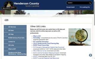
Henderson County GIS
BizScore
Contact Information
-
Address
200 N Grove St #86B, Hendersonville, NC, 28792 -
Phone
(828) 698-5124 -
Website
hendersoncountync.gov
Location
About Henderson County GIS
Henderson County GIS is an IT support service in Hendersonville, North Carolina, providing geospatial data, mapping tools, and technical resources for public and professional users. The department supports government operations by offering access to critical GIS layers, statewide orthophotos, parcel data, road networks, and environmental datasets through ArcGIS REST services and NCOneMap. It serves county agencies, local governments, emergency management, environmental planners, and the public with tools for flood planning, landslide information, soil surveys, and infrastructure mapping. With a 4.00 rating based on user reviews, the service is recognized for its reliability and accessibility in delivering essential geographic information.
Henderson County GIS operates as a specialized division within the county government, maintaining and distributing geospatial data for both internal use and public access. The department provides online tools for real property searches, tax bill lookup, and data requests, enabling users to download LiDAR data, floodplain maps, and other geospatial resources. It supports advanced users through ArcGIS Online and REST services while also offering user-friendly platforms for general map exploration. The service integrates data from state and federal agencies, including the USGS, NCDOT, NC DEQ, and NRCS, ensuring comprehensive and up-to-date geographic information for planning, emergency response, and public transparency.
Located at 200 N Grove St, the office sits just a short walk from the Henderson County Courthouse, less than a quarter-mile from the Henderson County Sheriff’s Office, and adjacent to Dr. Martin Luther King Jr. Memorial Park. It is situated near North King Street and South King Street, within close proximity to the Historical Downtown area, placing it at the heart of Hendersonville’s civic and administrative core.
Though no score strengths are listed, the department’s consistent delivery of authoritative, standardized GIS resources reflects its foundational role in county operations. Its integration with state and federal data systems underscores its reliability and technical credibility across public services. As a central provider of geographic intelligence in Hendersonville, Henderson County GIS enables data-driven decision-making across local government and community planning.