Georgia Land Surveying
Contact Information
-
Address
155 Cliftwood Dr NE, Dunwoody, GA, 30328 -
Phone
(404) 255-4671 -
Website
georgialandsurveying.com
Location
About Georgia Land Surveying
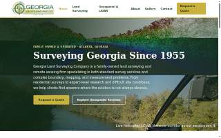
Georgia Land Surveying is a surveyor in Dunwoody, GA. Established in 1955, the firm is a family-owned land surveying and remote sensing company that has remained under family ownership and operation since its founding. It spans three generations of surveyors and is currently led by Josh Lewis IV, a licensed surveyor, testifying expert witness, and helicopter pilot who flies the firm's own aerial mapping missions. The business specializes in both standard survey services and complex boundary, mapping, and measurement problems, serving clients across the state of Georgia from its Atlanta office.
The firm offers a wide range of geospatial solutions, including commercial surveying, residential surveying, expert witness consulting, and airborne LiDAR mapping. Commercial services include ALTA surveys, boundary retracement, and due-diligence surveys for complex properties, backed by what the firm describes as the largest collection of surveys and land records in Georgia. In many metro Atlanta counties, these internal records are more extensive than those held by the Clerk of Court, allowing the team to retrace boundaries with conflicting legal descriptions and provide definitive answers. Residential services focus on metro Atlanta, with boundary surveys typically quoted within 24 hours. For expert witness work, the firm handles property disputes, adverse possession, and accident or crash-scene reconstruction, including recognized work in Georgia's 2025 real property case of the year. Aerial mapping is conducted using helicopter and UAV LiDAR with survey-grade control, flown in-house from the firm's own Robinson R66 and drone fleet. Additional services include mobile and terrestrial laser scanning for roadway corridors, campuses, and structures, as well as aerial photography and GIS datasets for engineers, architects, and contractors.
The office is located at 155 Cliftwood Dr NE. With over 70 years of continuous practice, the firm combines old-school research methods with modern technology, having evolved from steel tape and transit tools to current geospatial systems. This long history of fieldwork and record-keeping enables the team to tackle difficult site conditions and provide solutions where the answer is not always obvious.
More Businesses in Dunwoody, Georgia
- Septic BlueBizScore 77
- The Joint Chiropractic of DunwoodyBizScore 75
- Atlanta DUI Lawyer GroupBizScore 75
- Emora Design StudioBizScore 75
- Tim Maitski of Atlanta Communities Real EstateBizScore 73
- Grease Monkey of DunwoodyBizScore 71
- Atlanta Specialized CareBizScore 71
- Simply Food Trucks of DunwoodyBizScore 71
- VRA Interiors – Atlanta Interior Designers of DunwoodyBizScore 71
- Nemat Law FirmBizScore 69
AI engine reads
Read by AI engines 2 times in the last 30 days.
Counted from AI crawler and assistant visits to this page, identified by user agent.
See the full AI visibility report for this business