Meta Geomatics PLLC of Morrisville
BizScore
Contact Information
-
Address
7314 Self Storage Rd, Morrisville, NC -
Phone
(919) 612-1187 -
Website
metageomatics.com
Location
About Meta Geomatics PLLC of Morrisville
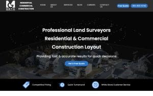
Meta Geomatics PLLC of Morrisville is a surveyor in Morrisville, NC. The firm provides comprehensive land surveying and geospatial services for residential, commercial, and municipal clients throughout Apex, Wake County, Chatham County, Raleigh, and the greater Research Triangle. Services include boundary and topographic surveys, site plans, permitting documentation, subdivision and lot recombination plats, ALTA/NSPS‑compliant surveys, and professional 3D laser scanning with reality‑capture technology. With more than ten years of experience, the company serves homebuyers, contractors, developers, lenders, and legal teams, delivering millimeter‑accurate data and fast turnaround. Meta Geomatics holds a 4.90 rating from its reviewers.
The company blends traditional surveying expertise with modern geospatial tools. All fieldwork is performed by or under the direct supervision of a licensed Professional Land Surveyor, using survey‑grade GPS/GNSS, robotic total stations, and LiDAR‑based 3D laser scanners on every applicable engagement. Clients receive plain‑language timelines, milestone updates, and deliverables such as CAD‑ready boundary plats, georeferenced PDFs, point clouds, and Revit‑compatible BIM models. Meta Geomatics leverages deep knowledge of Apex permitting workflows, Wake County GIS standards, and North Carolina DOT right‑of‑way processes, and its crews have active experience along corridors including US 64, NC 55, and NC 540. Most inquiries are answered with a detailed quote within 24 hours, reflecting the firm’s responsive scheduling.
By pairing licensed professional oversight with advanced reality‑capture technology, Meta Geomatics delivers precise, regulator‑compliant surveys that meet the exacting standards of lenders, title companies, and municipal agencies throughout Morrisville and the surrounding Triangle area.
Services:
- 3D Mapping
- BIM Modeling
- Land Surveying
- Laser Scanning
- Scan to BIM