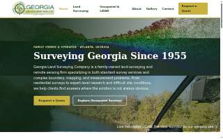
Georgia Land Surveying of Mableton
Contact Information
-
Address
155 Cliftwood Dr NE, Mableton, GA, 30328 -
Phone
(404) 255-4671 -
Website
georgialandsurveying.com
Location
About Georgia Land Surveying of Mableton
Georgia Land Surveying of Mableton is a surveyor serving Mableton, Georgia. The firm is a land surveying and remote sensing company that handles both standard survey work and complex boundary, mapping, and measurement problems. Its commercial surveying services include ALTA surveys, boundary retracement, and due-diligence surveys for complex properties and large projects. Residential surveying has been a part of the practice since 1955, with boundary surveys quoted within 24 hours. The firm also provides expert witness and forensic services for property disputes, adverse possession, and accident and crash-scene reconstruction, along with airborne LiDAR and mapping flown from its own Robinson R66 helicopter and drone fleet, mobile and terrestrial laser scanning for roadway corridors, campuses, structures, and as-builts, and aerial photography, orthophotos, photogrammetry, and custom GIS datasets for engineers, architects, contractors, and agencies.
Georgia Land Surveying Company was established in 1955 and has remained family owned and operated, spanning three generations of surveyors. It is led by Josh Lewis IV, a licensed surveyor, testifying expert witness, and helicopter pilot who flies the firm's aerial mapping missions. Over more than 70 years of continuous practice, the firm has compiled a large collection of surveys and land records in Georgia, and in many metro Atlanta counties those records are more complete than those held by the Clerk of Court. The firm is routinely asked to supply missing files or illegible documents to county and court systems, and that archive is what allows it to retrace a 100-year-old boundary with conflicting legal descriptions and deliver an answer rather than an argument. Its practice has moved from steel tape and transit to modern GNSS equipment while keeping the same research foundation.
The office is at 155 Cliftwood Dr NE, and the firm serves the entire state of Georgia from its Atlanta office.
Georgia Land Surveying of Mableton pairs seven decades of accumulated land records with in-house aerial and scanning technology, which is what lets it take on boundary and mapping questions in Mableton and across Georgia that other firms turn down.
More Businesses in Mableton, Georgia
- Moor GraphixBizScore 73
- Orangetheory Fitness of MabletonBizScore 72
- MPC Roofing & ConstructionBizScore 72
- Hammers Car Accident & Personal Injury Lawyers - Mableton OfficeBizScore 71
- The Pizza SpotBizScore 71
- Xclusive Home TheaterBizScore 71
- Ricka Websites And Logos of MabletonBizScore 71
- Premier Security Inc.BizScore 69
- Atlanta West DermatologyBizScore 68
- Mableton Family DentistryBizScore 67
AI engine reads
Read by AI engines 2 times in the last 30 days.
Counted from AI crawler and assistant visits to this page, identified by user agent.
See the full AI visibility report for this business